 Cruise to Kingcome Inlet
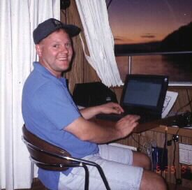
|
The following notes were taken by the author aboard the "QE Too",
a thirty one foot Cruise-A-Home. The cruise begins at the
Tacoma Narrows Marina, located just south of the Tacoma Narrows
bridge then northwestward through the inside passage of
Vancouver Island to Kingcome Inlet and Greenway Sound.
The author returned to Seattle aboard Kenmore Air after
two weeks, but the cruise continued for a total of 30 days
and 1000 nautical miles to return to the Narrows Marina in Tacoma.
|
| Friday 27 June, Narrows Marina to Kingston, 34 nm | |
|---|---|
|
After loading the boat with all our personal effects and provisions,
we got underway from Tacoma in the early afternoon and started our
cruise aboard the QE Too. Waters and winds were calm. There were
three persons on board, the Captain, the tour director, and myself.
The cruise today was mostly uneventful except for a near miss on a
fairly large floating log. I noticed having an autopilot can easily
lead to an unmanned helm. Found that the Captains chair at the helm
really "squeaked" badly due to cracked welds at the bottom mount.
I lubricated it with spray lubricant and said good-bye to the noise.
Next I prepared my crab pots and found I was
|
unable to attach bait
due to lack of safety wire and no bait. Seems like we always forget
something! There was a quick rain squall after arriving at the port
of Kingston. After the short squall I launched the dinghy and cruised
around near the ferry dock. Later, I walked around town a little - very
nice little town. We spent the night at the guest dock in Kingston -
Appletree Cove and headed for bed around 9:30. The guest pier filled up.
Unfortunately we had very "noisy" neighbors right next to us - talked
all night. During the middle of the night I got very cold and I started
the electric heater, thanks to shore power.
|
| Saturday 28 June, Kingston to Blakely Island Marina, 61 nm | |
|
After waking up with a cup of coffee we motored over to the
gas dock to fill up on fuel and emptied the waste system. Getting
under way I piloted out of the harbor up on the fly bridge. The
weather mild with light winds - fairly overcast but warm. From
the aroma emanating from the cabin below, I could tell that
Breakfast was being prepared. As we crossed the shipping lanes
that enter Puget Sound from Admiralty Inlet we saw two large
seagoing tugs escorting a huge oil tanker ship on its way
towards Seattle. Transferring command of the helm to the
steering station below I enjoyed breakfast with the tour
director while the Captain piloted the boat. After cleaning
the dishes, I sat down at the computer here to start these
notes. Continuing on now, it's nice to have a fully integrated
navigation and autopilot system; all you need to do is have
the autopilot follow the GPS (global positioning system)
with a map display on the computer to verify your position.
But you must also keep a sharp eye out for floating debris.
With the GPS NMEA output connected to the computer serial input,
you can see the boats position and path on the computer screen
and all the small deviations that are made to avoid vessel
collisions. As the
|
tour director had a little snooze,
I checked around the decks and engine for normal conditions
and found that the Captain had left the key ring with the
deck fitting key on the side of the boat - possibly could
have lost it overboard if we hit a large wave. I retrieved
the ring to safety and found engine conditions normal.
After lunch we traversed the narrow Deception Pass.
Waters were fairly calm as we passed through with the current,
sometimes reaching 15 knots speed-over-ground as we went.
During a quick stop in Flounder Bay near Anacortes, we fueled up,
got crab and fishing bait, and ice for the perishables. Arriving
at Blakely Island Marina, I launched the dinghy again and brought
the crab traps but didn't catch any keepers. After dinner, I got
the bucket and brush out and scrubbed down the upper deck of the
boat, as it was still very dirty from its long winters moorage in
Tacoma - the birds sometimes roost in the rafters of the slip
leaving droppings all over the top of the boat. After I put the
dinghy away for the night, we all relaxed on the newly cleaned
upper deck and witnessed a very beautiful sunset. Still remembering
the pressures of modern society, I realized once again what relaxing
is all about!
|
| Sunday 29 June, Blakely Island Marina to Sucia Island, 20 nm | |
|
Today things got off to a soggy start as it had poured down rain
all night. After a quick trip to the Blakely store to mail some
things and look around, we set out for our next destination,
Sucia Island. As the day progressed the weather started to
cooperate and get better; we made a short stop at the Orcas Island
ferry landing, as we had on my first boat through here at age one.
I bought a newspaper while the tour director continued to prepare
breakfast. As we continued on, it started to actually get nice.
Stopping briefly at Jones Island, the Captain and I took the dinghy
into the State Park dock to explore the island after breakfast.
We walked toward the south side and we could see that the island
had experienced some heavy forest damage, obviously from a heavy
storm. We also saw three small deer that didn't seem to mind our
presence. Then back to the boat we continued toward Sucia Island,
but took a detour so I could go fishing near the north end of Orcas
Island and boy did that pay off. After putting in a herring on a
double hook just west of Parker Reef - within 15 minutes I caught
our dinner. We made our way on now to Fox Cove in Sucia
|
Island and
tied up to a buoy. This little bay is particularly interesting for
the sculpting of the sandstone shoreline. The Captain and I launched
the dinghy and reported in at the Park station. Later I took a good
nap and the Captain took the dinghy out on an exploration trip
somewhere out of sight. The tour director did whatever it is she
does while we are busy. Now the sun is shining beautifully with
blue skies above. Time now for dinner - fresh fish! After our dinner,
I took the dinghy in to shore for a walk around the old stomping grounds;
I recognized a lot around this island as we stayed here many
times in the past. Hiking around a while, I took some very good
sunset pictures. Located on the side of a small hill overlooking
the bay on the other side of the island, I found a rock that has
a seat for two carved in it - a perfect spot for a couple to enjoy
the heavenly view together! Returning to the boat, we watched a
Blue Heron, a Seal, and a Bald Eagle engage in their evening snack
time along the shore as we watched the sun over the dead still
and calm bay. Bed time now as the dew falls on everything and
the evening cools off.
|
| Monday 30 June, Sucia Island to Bedwell Harbour, 14 nm | |
|
This morning we woke up to find that the entire area around us was fogged in.
The tour director and I sang "Happy Birthday" to the Captain as it was his birthday today.
Following a quick breakfast and after the fog had lifted a little,
we set out for Bedwell Harbour; maintaining a slow headway
as we were still in the fog and not able to see land -
we relied on the GPS and computer map display to guide
us as we went, keeping a watchful eye out for other boats
as we sounded the horn every sixty seconds and finally made
our way into the bay where Bedwell Harbour is located. As we
entered the area, land eventually became visible; it was like
we had entered a strange new world where things are just a
little bit different - including the flag. After clearing
Canada customs we secured a spot on the guest dock and settled
in for the night. With the fog starting to lift now,
other boaters on the guest dock started leaving; and
arriving boaters
|
flooded the customs pier. It was interesting to sit
and watch all the activity in the harbour.
Also noticeable was the lack of courtesy some boaters
showed when it came to keeping their wake down.
The Captain and I walked up for a beer at the restaurant
in "town" and later set sail in the dinghy for a little
adventure through the narrow Pender Canal and saw the
low bridge connecting north and south Pender Islands at
the head of the bay. For dinner we had barbecued steak
for the first time. I went for a shower at the marina
and later watched another wonderful sunset off the
fly-bridge. Getting to bed this evening proved to
be a little bit of a challenge compared to other
nights; as we found that the marine head started
malfunctioning. Whenever this happens the Captain
ends up in the panic-mode to unsuccessfully get it fixed.
It rained a couple of times through the night.
The head repair will have to wait until tomorrow.
|
| Tuesday 1 July, Bedwell Harbour to Nanaimo, 40 nm | |
|
Normal daily operations were suspended this morning and all efforts
were concentrated on the marine head repair. Tool boxes were taken out and
all equipment was strewn about the cabin as we tried to zero-in on
the problem, The Captain ended up in a semi-panic-mode and
tempers flared again until we finally found that the sea
water intake line was clogged by seaweed. We traversed the
narrow Pender Canal north of Bedwell Harbour and continued on.
I took the helm as the Captain finished work on the marine head,
the tour director helping when she could. All systems mostly back
to normal now, we went on through Dodd Narrows and on into Nanaimo.
Prior to arriving in Nanaimo, we came upon a boat that was obviously
in trouble and needed assistance getting back to the harbour.
We took him in a stern tow and dropped him off at the
|
gas dock and continued on to our overnight moorage on "G" dock in
Nanaimo Harbour. After a quick shower on shore, I took a
small walk around town and found that most everything was
closed due to Canada Day. Following a hamburger dinner,
the Captain accompanied the tour director for a short
walk down the boardwalk. There were many little shops
selling souvenirs and such; we also heard a man playing
an accordion, a woman singing, and two ladies playing
flutes along the way. Later that evening I took a
small ferry out to the Dinghy Dock Pub out on Protection Island -
located just outside the harbour entrance to Nanaimo.
Returning after having a beer there, we all hit the hay.
I had a terrible sleep, as the moorage is located right
near the center of town - sirens, ferry whistles,
and drunken sailors yelling, kept me awake.
|
| Wednesday 2 July, Nanaimo to Pender Harbour, 29 nm | |
|
The Captain started things off again this morning with the
coffee making ritual. Soon after that, I went to the mall to shop
around for some stuff. I picked up some fresh bread and got some
Canadian beer at the liquor store. Back on the boat now, we prepared
to get underway again by filling the potable water and gas tanks.
The weather today was mildly warm with a light wind from the north.
We exited Nanaimo from Departure Bay where the BC ferry pulls in.
Continuing north now - staying out of the Navy torpedo testing area
called "Whiskey-Golf" or "WG" as it was active today. As we passed,
we saw that there were two Navy boats tied at a buoy here, each
displaying a red flashing light that signaled caution; there was
also a seaplane apparently clearing the range area every now and
then. I went down for a nap to catch up on my lost sleep from
last night. We continued on across Malaspina Straight on the
way to Pender Harbour. I was awakened by a large "thump" on
the hull and found out that the Captain at the helm had
become distracted again and hit another piece of floating
debris (log). Arriving in Pender Harbour, the tour director
and I went to the fly bridge to check things out as we passed
through the narrow opening to the harbour.
The weather has cleared up very nicely now |
and considerably warmed up. Spotting a nice looking
marina, we instructed the Captain to pull in.
As we did, we were greeted by Wally, the very nice owner
of Fisherman's Marina and Resort, who instructed us which
slip to pull into. Today I launched the bicycle for the
first time and peddaled around a little. Later, I set
out in the dinghy in search of some new oar locks and
found that the only place that would have any was closed
for the night. As I filled the gas tank in the dinghy motor,
I accidentally lost the entire filler neck overboard
(after filling the tank) - oh well - we needed a new tank anyway.
Returning to the boat, the tour director was fixing dinner
and had me start the barbecue for our steaks. The Captain
and I and went for a short walk around the resort and marina
at sunset. I bought a five day non-resident fishing license
here at the store, and the Captain deposited one small
bag of garbage for a fee of $.50. We played with Wally's
dog on our way back to the boat. As I put the dinghy up
for the night we all noticed that this moorage had turned
out to be the most quiet and enjoyable of any we've stayed
at so far along the way - definitely a good place to visit
again. We retired for the evening - fighting off the mosquitoes
that snuck in while the windows were open earlier.
|
| Thursday 3 July, Pender Harbour to Prideaux Haven, 50 nm | |
|
Waking up from the best night I'd had so far, I filled
the potable water. Breakfast pancakes were ready soon thereafter and we said good-bye to my favorite spot so far.
We made a short stop at the small marina in Welbourn Cove where we purchased some new oar locks for the dinghy and
another gas cap to replace the one I lost yesterday. Leaving Pender Harbour and entering Malaspina Straight again,
I went upstairs and caught some rays as the sun was out very nicely this morning. Today we had an exceptionally long
cruise to our next destination - Desolation Sound; passing by numerous fishing boats, crab pots, other people cruising
and small islands along the way. We finally arrived and as we entered, the bay was flanked by tall rock-hills and a
large mountain off to the left called East Redonda Island. Continuing on through to Prideaux Haven we set anchor in
Melanie Cove. This is where most of the pleasure boats were anchored. It is about 200 yards
|
wide, providing for a very protected area where the water is always dead still. The tour director and the Captain launched the dinghy while
I took a shower with the last-remaining hot water. The weather now was very nice, sun shining, and very warm. Some of
the other brave boaters were swimming off their boats as I went up top to listen to the CD player, have a beer, and
relax. Looking around you can tell and appreciate why this area is a boaters paradise. Later, the tour director and
the Captain returned from their expedition, and turned the dinghy over to me. I went around exploring the area -
enjoying the beautiful calm and quiet that this place provides. Returning just prior to sunset, we all went up top
to sit. The tour director managed to liven things up a bit by spilling my beer all over the upper deck. I tried
fishing in Canada here for the first time, but didn't catch even a bite. We all went for bed early tonight and
got a very good sleep in before morning.
|
| Friday 4 July, Prideaux Haven to Big Bay, 28 nm | |
|
Happy Fourth of July - but don't expect to hear any firecrackers
or anything else up here in Canada; the Fourth is not a Canadian holiday,
so everything here is still very quiet. The Captain cooked up some French
toast and the tour director warmed up some day-old coffee for me.
Following breakfast we got underway for our next destination, Big Bay.
Water conditions are very calm now, cruising along at a steady 8 or 9 knots.
I reported to the sun lounge up top to catch some rays and listen to my kind of music.
Along the way we passed a cruise ship that looked very similar to the
Virginia V (a steamboat in Seattle that I used to work on) called
"The Spirit of '98". It was standing along the side of the channel, while
up top the ship's chef was barbecuing some fixin's for the passengers.
The boat was beautifully painted white with dark blue trim and had about four
decks in all. Continuing on we saw several bald eagles scouting around for their
daily meal along the shore. I've never seen so many eagles. As we approached
Harbott Point on Stuart Island, we started to make our
|
way up Yuculta Rapids. Both I and the tour director were sitting on the flying bridge, with the captain
piloting from below. We were never warned by the Captain that this area had the
potential to be very turbulent due to the currents one could encounter here.
Traveling along at about 10 or 11 knots, our speed over ground rapidly decreased
and almost all directional control was lost as we were tossed around by 6 to 7
knot currents and whirlpools! All of a sudden we went from calm waters to almost
total chaos. Then, if that wasn't enough, we had to dodge whole trees and clumps
of floating debris coming at us from all directions. At one point the boat was
turned fairly violently and the refrigerator came open depositing half the
contents on the floor of the cabin. Keeping a lookout from up top, I could
see that we had lost all forward motion now and were traveling almost sideways.
I called down and told the Captain we needed more power, and he gave it all
she had. Regaining some headway in the direction of Big Bay, we labored ahead,
|
|
fighting the current all the way, pitching back and forth and holding on! Finally,
turning around Whirlpool Point, we entered Big Bay, slowed down, and headed for
the gas dock - whew! We tied up and loaded about 100 gallons of gas. While talking
to the gas dock attendant, she told us that everyone was watching us as we came
into the bay around Whirlpool Point. She said we need to pay more attention to
our current tables and hit the area at slack current (the Gillard Pass peak
current was 9 knots that day) - no kidding. I'll remember this for the next
time. Tying up for the evening now, we took a walk around the small settlement
of Big Bay - a store, a restaurant, laundry, and shower facilities, and trails
to peoples homes - no roads - no cars. We had dinner in the restaurant - very
nice after one week on the water. I had New York steak with prawns and a glass
of red wine with home made white bread - fresh from the oven. After dinner,
I took a short walk down the dirt path. Walking along I saw that most people
built their homes on the waterfront and just up from their houses, |
had placed their generator sheds very close to the trail. Ten minutes later,
I turned around to head back as I was making a nice meal for the mosquitoes
in the woods. Arriving back at the boat, I went into my bed making ritual
again - get out the sleeping bag, pillow, air mattress, and inflator,
take down the table, arrange the cushions, inflate the air mattress, set up the
sleeping bag, place the pillow, and finally, hit the hay. The tour director
decided to take a shower aboard the boat before going to bed, and just as
she started, a fairly large boat came into the bay and left a gigantic wake
for all the boats in the marina! Boat owners, including our Captain, wearing
his pajamas, as were other boat captains, were alarmed and got out to check
their lines - how rude some people can be. The boat rocked for at least
five minutes, lines tugging on the dock. The tour director about had a
heart-attack as this all happened while she was in the shower. Finally,
after all that excitement, everyone had a good nights sleep. |
| Saturday 5 July, Big Bay to Blind Channel, 17 nm | |
|
Again, we started with coffee and breakfast, as we filled
the potable water; getting underway around 10:00 a.m.. We went
with the current this time, making our journey much more enjoyable.
The weather was calm today, with mostly overcast skies, and
cooler air. Leaving the Big Bay area we saw a large, dead
tree on shore that provided a perfect spot for a bunch of
bald eagles to build a nest.- There were two perched there
as we passed. Today's cruise only took about two hours, going
by nothing too much special. We arrived at Blind Channel and
tied up at the dock. Soon after, we saw and talked to the pilot
of a Kenmore Air Harbor Beaver , a single engine, nine cylinder,
radial. He was picking someone up here today. Following that
excitement, I wandered up to see the resort that consisted of
a restaurant, store, showers, laundry facilities and a few
cabins. I purchased a fishing lure, then, launching the
dinghy, I loaded it with all my fishing and crabbing gear
and set out on a fishing expedition. Crossing the channel
to the other side I set the crab pots, put the line out to
see what's down there and didn't find much of anything.
Retrieving the pots with nothing in them,
|
I decided to
turn back for the resort and found that the Captain made
a mistake in telling me which direction the current was
going through the channel that separated me and the marina.
As it was just a half hour past flood tide, I was cautious to
make sure that I could keep up with the current before
setting out across the passage, then did so and made it
without any problem - good thing the motor didn't poop
out on the way. After returning safely , I was tired,
took a nap, and woke up to the sound of rain drops on
top of the boat. The weather has turned worse now,
winds and rain kicking up with low clouds setting in
around the bay. As evening came, it was time to get
ready for dinner ashore in the little restaurant.
We enjoyed a wonderful German-style meal, complete
with authentic hand made decorations. We met the
people that owned and operated the place - very nice,
warm folks. Returning to the boat, we sat around
keeping dry, and the tour director and I continued
writing our stories, the tour director's on paper,
mine on the computer. Getting late now, we turned
in for the night as we were to rise early next
morning to beat the currents and tides.
|
| Sunday, 6 July, Blind Channel to Lagoon
Cove, 47 nm and Lagoon Cove to Simoom Sound, 34 nm | |
|
Up this morning at about 5:30am, we got underway just after sun-up
to beat the tidal currents going through Greene Point
Rapids and Chancellor Channel. The weather was very calm and clear with wisps of low clouds in
the distance with the sun on the rise. Passing up the east
side of East Cracroft Island, we made our way north to Minstrel Island
and passed west through "The Blow Hole" and stopped at the guest/fuel dock of Lagoon Cove Marina.
The folks here that run the small resort were nice and
fixed us up with a full tank of gas and water. We got ice and I got a fishing lure for large bottom
fish as they said this was a good area for them, and crab too. I took a short walk around to see the place,
and returned to the boat and found that the tour director had decided to continue
on as the water conditions were so calm, to an area northwest of Gilford Island called
Simoom Sound. Getting underway again, I retired to the bunk to get some missed |
sleep.
The tour director woke me up to see some large mountains we were passing through -
really something to see, water falls and all cascading down sheer cliffs.
The weather now started deteriorating somewhat with gray clouds moving in all around and a little
wind kicking up. Taking a slight detour, we passed by Gormely Point and saw a very beautiful
natural water fall that dumped right into the bay. It came down a chute that would make
a really fun water slide. The weather was now turning to rain. We continued on and entered
the opening to Simoom Sound; making our way almost to the end of the bay and set anchor
in a very protected little spot called McIntosh Bay. The Captain and I tied a stern line
to shore here as we had done before. The weather began turning a little more clear now so
I went out on a little fishing expedition towards the middle of the bay. After hitting
bottom with a 6 1/2 oz Gibbs Cod Buster (purple), in what |
|
seemed to be a very rocky spot,
about 150ft down, within 3 minutes I had a bite; retrieving the line I found I'd caught
a nice little Rock Cod; getting him on board, I returned to the bottom with the same setup,
and within 10 minutes reeled in a 9 1/2 pound beautiful Red Snapper. As he came up from the
bottom, he barfed-up his stomach (as usual with Snapper); I hit him over the head with a
hammer, and all of a sudden, the lure got cut off and he was loose off the line! In a
hurried panic, I grabbed for his tail, but he slipped right out. Grabbing again before
he sank to the bottom or swam away, I managed to get him into the boat; after a few good
hits with the hammer. Returning to the QE Too within less than a half hour, the tour
director and the Captain were really surprised to see what I'd brought back. Cleaning
the small rock fish gave me something to put in the crab pots for bait. Then, after
putting the crab pots out, I returned to that fishing spot I'd been at before to just
catch and release for a while; with a squid-jig attached. Slowly trolling along, bobbing
along the bottom, a big one hit; this one was really big. I could tell by the way he fought
on the line. The fishing pole curled all the way over. I tried to start reeling him in.
This guy was stubborn and wanted to stay at the bottom; three or four times he made a run
for the bottom and I was forced to loosen the line out to let him run. After we |
both tired a little, I managed to start
getting him to the top. As the sinker on the line became visible,
I couldn't believe what I saw following at the end of the line - a HUGE Ling Cod that looked
like a sea serpent. He seemed about half as
long as the dinghy and still very much alive. At
this point I was beside myself as I didn't know what I was going to do with him - he was so
big - I wasn't prepared to do anything with a fish this size. Seeing that the hook was set
very well in his upper jaw, I kept tension on the line, started the motor, and made my way
at an idle to a commercial fishing boat that had anchored for the night about 200 yards away
from me. My fish cooperated for the most part until I reached the fishing boat where I called
out for help; aboard the "Solar Breeze". Two guys came to my rescue, gaffed the fish, put him
on their deck, and cleaned him for me. Thanking them, I returned to the Q.E.Too, where the tour
director and the Captain were flabbergasted at what they saw in the boat with me. I measured the
length with the head to be just over 40 inches long and the guys on the fishing boat guessed he
weighed about 25 pounds. After all the excitement, I filleted all of my catch, and cleaned up
for dinner; at about 9:00pm. The tour director prepared a great, fresh, Ling Cod dinner -
wow was that good! After all that, I was so pooped out, I made my bed and went straight to sleep.
|
|
|
|
| Monday, 7 July, Simoom Sound to Echo Bay, 8 nm | |
|
It was raining this morning as we woke up; The Captain prepared another
French toast breakfast, and I caught up on my notes here on the computer.
Later, we weighed anchor and got
underway for Echo Bay. As we left the shelter of McIntosh Bay,
we discovered that the winds had come up and caused the previously
calm water to really turn-up. The Captain and I went up top to stow
the bimini-top because it looked like it was going to blow away.
Finally getting it put away, the Captain decided it was too rough,
so we returned to nearby the same area we had anchored in previously
and dropped anchor again until the weather calmed down. While we waited,
another big pleasure-cruiser motored through, so we contacted them via VHF
and asked what the weather conditions were like in the channel.
The "SuzyQ" responded, saying that we would do better just staying
where we were - so we did for a while. About an hour later, the wind
had calmed down slightly and we pulled anchor to give it another try. I
drove from up top outfitted in my rain gear. As we exited the bay into
Raleigh Passage, we checked to make sure it wasn't too rough - it wasn't.
So we zipped across at a faster-than-normal cruise speed and made it
without much trouble and tied up at the guest dock at Echo Bay Resort.
Noticing that most of these places were called "resorts", we wondered
what is it that makes them "resorts"? Surely, there wasn't much to make
this place much like a "resort" - especially it's fairly unprotected
location in relation to Cramer Pass. Fishing boats plow-by and create
quite a wake for us to endure as well as some pleasure boats. After
tying up at the dock, we all took a |
walk up the dock to the "big"
store. They were outfitted quite well for a remote store - they even
had a walk-in cooler for perishables. One unique thing about this place
is that the store and other facility were located on top of a section
of the old Lake Washington Floating Bridge that had collapsed a while
ago. It was permanently attached to shore with big steel tubes welded
together and attached to the rocks. I explored the tiny bay we were in
with the dinghy, visited two wrecked boats ashore, and walked up to see
the B.C. Park at the head of the bay. Later, The tour director and I
took the dinghy over to the other "resort" on Echo Bay and visited a
small arts and crafts store, met the owner, and petted her cat. Then,
we set out on the "hi-seas" and went two bays down to the "Corkies"
floating bakery. On the way we saw another two bald eagles soaring
around the tree tops not far from us. At the bakery, we bought some
cinnamon rolls and coconut macaroons and talked with the lady that
runs the place. She told us of how she came to live there - first
building a house on floats, and later saving up enough money to build
a brand new floating bakery. We also met her dog, Rosie. Back at the
marina, we returned with our goodies and got out of the rain that
had started. I went up to the phone and called my room mate, Pat.
We had a good $11.50 conversation, Later, dinner was baked red
snapper and corn. And for dessert we had the cookies we bought
earlier. Before turning in for the night, I went up to take a
shower in the facilities, then, pulled in the dinghy that was
starting to fill with rain water, and finally - hit the hay.
|
| Tuesday, 8 July, Echo Bay to Kingcome Inlet, 25 nm and Kingcome Inlet to Greenway Sound, 23 nm | |
|
I woke up this morning with a pounding head-ache.
Before I knew it, the Captain had the QE Too ready to go and
the engine warming up for our trip out. We stopped at the fuel
dock on the way out and found out they didn't open for another
hour or so, so we waited. Keeping in mind that this was supposed
to be a "resort", I don't give this place a high recommendation
for a return visit. Stop only if you need supplies or gas, but
don't ever spend the night here again! Because of it's poor
location in relation to Cramer Pass, we rocked the night away
with the incoming waves and wakes that were provided by all
the passers-by (no one seems to care about the wake they leave).
Putting that all behind us, we made our way for Kingcome Inlet
with much calmer waters than yesterday. Along the way we saw
some more bald eagles, some seals sunning themselves onboard
a giant floating tree, and quite a few natural water falls
that cascaded down steep rock cliffs. Arriving, finally, at
the head of the inlet we discovered a river that emptied
into the bay, and a small three section floating dock with
fuel barrels on it. Two commercial boats were tied up. We
tied up at the empty space on the dock,and the Captain went
for a quick ride in the dinghy. While |
he was gone, two guys
from the Indian Reservation up-river showed up in
little aluminum boat with outboard motors and unloaded a bunch of
propane and empty fuel barrels. They said "hi" and wondered
if the guy in the dinghy had life insurance? They warned
that The Captain was going into an area that was somewhat
treacherous and shouldn't be going up the river like that.
They offered to take me up river to see the Reservation and
I decided to go for some excitement. Not knowing what to
expect, I thought I might see some totem poles, teepees,
and people wearing moccasins smoking peace pipes walking
around - how naive! As we went up river, I could see what
they were talking about when they spoke of treacherous
waters - this was a very swift moving river that had many
floating logs and trees. It took about fifteen minutes in
driving rain at 3/4 speed to get to the Reservation. On the
way we passed a logging camp that was active and had a
parked helicopter. Arriving, Les, one of the Indian fellows,
pulled the boat up on the river bank and turned me loose.
He said to be back in about an hour. So I started walking
around. There was only one road, dirt - with many pot holes -
that went from one end of town to the other. The Reservation
was located along this
|
|
river that was flanked with very high
snow capped mountains. The houses I saw were of modern construction
type, some being absolutely brand new. Most others, however, were
in a miserable state of disrepair. As I walked along, passers-by
would smile and say "hi". One fellow I talked with told me of a
story that explained the white memorial stone which we saw along
the shore in Kingcome Inlet. It marked the sight where a father,
son, and relative from the reservation all drowned together.
I passed another marker for them that was located near the
Church (apparently Catholic). As I continued on, the weather
grew darker. Lightning and thunder roared from the nearby
mountains and the skies opened up - water came down as hard
as I've ever seen it; rain anywhere. Not having anywhere to
go, I took shelter in an abandoned house along the road.
Waiting under the eves, it didn't look like it was going
to quit anytime soon so I grabbed a piece of plywood from
inside and used it as a makeshift umbrella while I walked
back to the skiff. Upon my return, Les and his partner were
preparing to go down |
river again for another load to the dock
where the QE Too was tied. So I went with them again and
passed by a bald eagle resting on one of the tree stumps
along the shore - he didn't move - just watched us go by.
As we returned to the dock, I said good-bye and thanks to
my "guides" and we got the QE Too underway again. The
weather turned rough as we left Kingcome Inlet, so we
made a run for Greenway Sound. When we arrived, the Captain
got a slip assignment from the wharfinger and tied up for
the night. Greenway Sound resort is a very unique place -
the whole resort is on floating docks. No part of the resort
is located on dry land. With a lot of dock space for visitors
and seaplanes, they have a restaurant, salon, laundry, shower
facilities, and a couple of giant diesel electric generators
to keep the everything running. After checking-in, we had a
late dinner and indulged in the wonderful desserts they had
for sale in the store. The Captain and I had ice cream cones
and the tour director had rich chocolate cake. After that
we turned in for a very good night.
|
| Wednesday, 9 July, Greenway Sound to Echo Bay, 14 nm and Echo Bay to Port Harvey, 33 nm | |
|
I started this morning out with a load of laundry in the
laundry room; then I donned my rain gear and boots and took a
trip to shore with the dinghy in the rain. Close by the resort,
I landed at a small dock attached to a recreational park. Just
passed the picnic tables was about a mile-long trail which I
took and ended up at a lake. Walking along the forest trail by
myself got a little scary not knowing if I was going to visited
by one of our furry bear friends or something - so my lips got a
good workout whistling as I went (I learned this in Alaska at a
Ranger presentation I listened to once). Finally reaching the
lake, I found it was worth the hike - it was dead silent.
Returning to get my laundry, I found the Captain had already
got it for me and folded everything up - great. Stowing the
dinghy again, we got underway for Port Harvey with a stop in
Echo Bay for gas and propane. I had another nap along the
lengthy cruise from there to Port Harvey. Arriving safely,
we dropped anchor behind Tide Pole Islet. The weather had
cleared up by now, the |
sun was out and it was warm. The Captain
and I took an excursion in the dinghy together but didn't
see much of anything special. While the tour director
cooked dinner, I went out again and found some old,
abandoned, rusty logging chain on the shore. Thinking
it might make a good yard decoration back at the house,
I grabbed a short section and kept it as a souvenir.
I stowed it in the anchor locker in front of the boat
for retrieval later. We all had a good dinner, followed
shortly thereafter by a good sleep. Before going to bed,
the Captain and I set the anchor alarm on the GPS
(global positioning system) to warn us if the anchor
were to let loose. During the night I thought I heard
something hit the boat; so I got up to investigate.
As I did, so did the tour director and the Captain;
we had a look see around the place and couldn't see
anything out of order and went back to bed. In the
morning I figured that the noise I heard was the bimini
top attached to the fly bridge flapping in the wind.
|
| Thursday, 10 July, Port Harvey to Forward Harbour, 27 nm and Forward Harbour to Blind Channel, 17 nm | |
|
Keeping in mind that I needed to start getting back
to a place where I could fly back home, we made our way this
morning towards Blind Channel. On our way there we had an
unexpected surprise; we decided to take a scenic detour into
Forward Harbour just passed Thynne Peninsula. The tour director
got the handbook out and read up on Forward Harbour as we entered.
The book said that it is common to see black bear along the shore.
Not shortly after she read that, I announced that I saw a bear!
The tour director couldn't believe me until she saw him with her
own eyes. Sure enough, there was a black bear down on the beach
turning over rocks to see what's underneath. He looked to be
about 300-400 pounds. The Captain turned the boat his way and
the tour director and I got our cameras and binoculars ready
to check him out. As we got within 200 yards, he looked up right
at us and didn't seem to mind us much. He just continued on
turning rocks over. However, as the boat got closer, Mr. Bear
got a little concerned and started slowly climbing up the beach
towards the trees. Soon he was out of sight. We continued on to
nearly the end of
|
the Harbour. Because it was a dead-end, we had
to go back the same way and as we did we kept our eyes open for
Mr. Bear, but didn't see him again. Later, as we went through
Greene Point Rapids at slack current, we saw a tug boat towing a
very large crib of logs on their way to a lumber mill somewhere.
Entering Blind Channel again, we tied up at the dock and I went
for a walk on the forest trails that were available. Along the
way I saw an abandoned log dump and its equipment, a couple of
gigantic Red Cedars, and some very pretty scenery. I had a drink
from one of the streams when I got thirsty - now that's what
I call fresh water. Luckily, I didn't get sick from it. I only
saw one other fellow along the way, and he was jogging the trail -
a lot more ambitious than I was. Returning to the settlement,
I stopped at the store and got some more beer and made my way
back to the boat to update these notes. It's about 7:00pm now
and time for dinner - ravioli's - no expensive restaurant
dinning tonight. After dinner I caught up on the notes, and
the tour director and Captain went up to the laundry room to
put their stuff in the dryer. We had a good night here again.
|
| Friday, 11 July, Blind Channel to Octopus Islands, 21 nm | |
|
We got up early this morning in order to make slack water
on the way to Octopus Islands. Thinking the gas dock would be open
at 7:30am, we made our way over there and found it didn't open until
8:30am - too late for us to wait around. The tour director mailed a
couple of letters at the Inn and we set out for Upper and
Lower Rapids along the north end of Quadra Island. The weather
was mostly calm today with patchy morning sun breaks and moderate
seas. We found that the Captains calculations were correct when we
passed both rapids with no problem. Traveling through a very narrow
passage, we entered the Octopus Islands Marine Park. Picking a nice
little spot along the northeast shore, the anchor was dropped and set,
and the dinghy was deployed to rig a stern line to shore.
After getting all situated, the tour director baked some
Red Snapper up for
|
lunch. I took the dinghy for a check
around all the little islands and inlets that the
Octopus Islands were made of. It's nice to see all
the seemingly untouched natural stuff around here -
trees with moss, rock formations along the shore, and
all kinds of birds flying around scrounging up their
meals. We watched a Blue Herin along the shore about
one hundred yards away, and a small raccoon competing
with him for waterfront fishing rights. Soon after,
the tour director cooked a gourmet meal for dinner -
baked salmon loaf with buttered pasta and chocolate
pudding with whipped cream. After the dessert, we had
the corn bread which the Captain had baked earlier, but
forgot to serve with the dinner. The wind calmed down
to not even a wisp and the sun came out bright for a
beautiful sunset. We had another quiet night.
|
| Saturday, 12 July, Octopus Islands to Refuge Cove, 23 nm | |
|
In no hurry this morning, I awoke to the sound of
coffee being made in the galley. We had a quick breakfast, and got
on our way towards Refuge Cove. Not much of anything out of the
ordinary happened along the way. We traversed the well-known
"Hole In The Wall" at slack tide and saw two log cribs being
towed. Arriving at Refuge Cove, we tied up at the public dock
and settled in to watch all the hustle and bustle around the bay.
I took a shower in the facilities here and later sat down outside
the gift store with a chocolate ice cream cone. It was fun to sit
and watch the boats come and go here. As soon as anyone pulled up
to the dock, they were greeted by the "Refuge Man" and were asked
if they had any garbage to get rid of - $3 for a grocery-sized bag
or $5 for a large garbage bag (garbage isn't accepted off the dock).
Refuge Cove businesses are run by a co-op with joint owners.
Everything is built on stilts above the rocks on the shore.
There are a total of four operations here - the store, the
gift shop, the hamburger stand, and the gas dock. The store
is very well stocked with
|
supplies, including booze, souvenirs,
books, fishing and boating supplies, and ice cream. The gift shop
has all kinds of neat little nick-nacks and all the stuff women love.
The hamburger stand is run by a very remarkable guy - you can tell he
just loves his job - he's very happy and proud to make your
hamburger - and they taste very good too! The gas dock is just
your everyday, run of the mill, gas dock - except here at seems
as if everyone that visits at the gas dock is in super-slow-motion;
it took forever and a day for a couple of boats I saw pull up there
to gas up. Today was very relaxing - I bought some souvenirs in the
store, and later had a good dinner. At about 8:00pm, a bell is rung
at the gift store signaling the opening of dessert time. Wonderful
desserts are served here until 10:00pm - which we took part in.
We talked with a school teacher from Port Angeles, WA. about her
and her husbands boat travels in the area of Desolation Sound
aboard the trawler-style vessel - "Sheba Queen" and took in the sun-set.
|
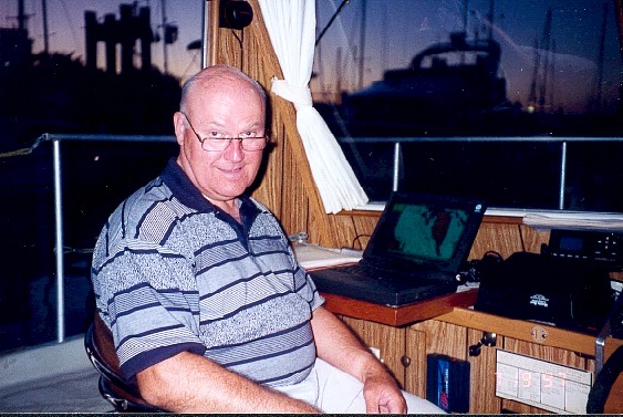
The "Captain" and "Tour Director" of the QE Too are the authors parents. |
||
|
 The Entrance to Gorge Harbour |
|
Tuesday 7/15/97 Gorge Harbour to Thunder Bay, 43 nmWednesday 7/16/97
|
Thursday 7/17/97, Egmont to Princess Louisa Inlet, 34 nm |
 Driftwood on approach to Princess Louisa |
 Entering Princess Louisa |
 The Head of Princess Louisa Inlet |
 Chatterbox Falls |
|
 The Skipper |
||||||||||||||||||||||||||||||||||||||||||||||
The total cruise distance was 1000 nautical miles with a total running time of approximately 118 hours. |
|||||||||||||||||||||||||||||||||||||||||||||||